Wayfinding has a unique ability to motivate, attract and properly navigate people to the places you are developing. That is the point after all, a vibrant community is the interaction of people together in the environment. Yet, it’s curious how often wayfinding and branded signage programs are left until the tail-end of a development project, often during construction and sometimes only as a missing requirement for occupancy. There is an enormous opportunity for more thoughtfully integrated approaches to wayfinding that ensure the intended markets and neighbors of your real property assets know where they are and how to get there.
When wayfinding strategy is integrated earlier in the architectural process it saves time, money, and resources. Real estate owners and investors are combatting interest rates with tighter budgets while implementing lean development strategies. Discussions around improved productivity in the construction industry have been happening for years. This calls for an approach based on a modular process to solve problems, and why we developed an off-the-shelf product called the Signage Allowance Matrix (SAM).
At Spaeth Hill, we are passionate about connecting people to the places you have designed, developed and built. Through wayfinding that aligns with your brand and your architectural vision, we inform neighbors and attract new visitors to the communities and places you’ve created—making them the vibrant environments you imagined during your master planning phase. There are many different ways for design to solve this problem, but it always starts the same way: How much signage is necessary and allowable in order to maximize visibility? We’ve templatized how we answer this question using the SAM.
How to Understand and Maximize Signage Allowance
Wayfinding is a tool that enhances brand awareness while conveying information and directions to and through a place. Signage allowance is a typical wayfinding pain point and it’s usually one of the first questions we get asked. It’s also the foundation of any wayfinding design project as recommendations must stem from data collected to ensure jurisdictional compliance. This is the beginning of our design process and we’re able to answer these questions accurately through the SAM.
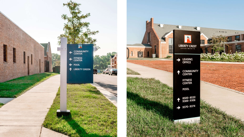
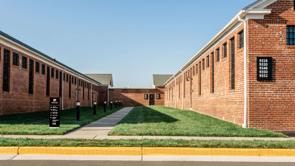
It’s important that property managers and building owners have a holistic and accurate survey of their exterior signage (monument signage, directional signage, digital signage, building mounted signage, tenant specific signage, etc.) next to their allowance with specific guidance on how to carefully maximize wayfinding and visibility. Knowing how much signage is existing and allowable then determines how much to offer a prospective tenant or add to your wayfinding strategy. Typically, this conversation usually stems from an important lease negotiation with a potential tenant who is interested in significant square footage in the building. It also comes up when tenants and visitors are consistently voicing confusion around wayfinding or when significant construction projects are about to commence.
SAM Details
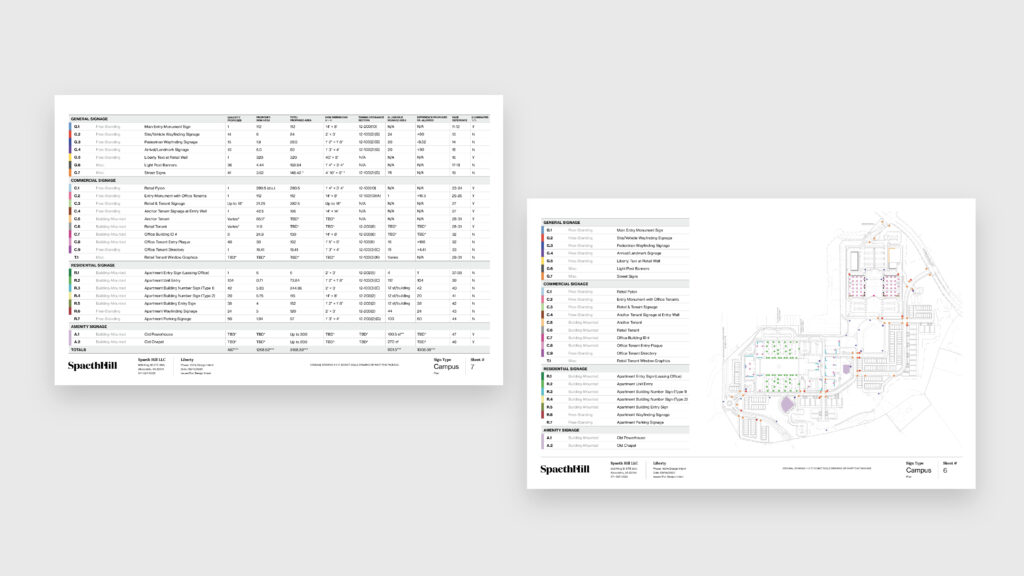
A SAM starts with site survey and thorough research. We review all existing signage in comparison and alignment to the zoning ordinance, comprehensive sign plan (CSP) or other concept plan documentation that regulates signage on the property. For building-mounted signs, we review the current building MASA and calculate the limits subtracted by what’s currently installed on the property. For wayfinding signs throughout the property, we document what’s existing by location and size. This information is folded into a site plan and a matrix that outlines everything on the property by line with square footage totals and permit numbers. As a bonus, the matrix is typically used in sign permit applications and is transferred to the property management team as a living document that can be updated as needed going forward.
Data points collected during the SAM process will inform wayfinding recommendations and considerations within the overall document. With all information formalized into an easily readable matrix decisions around allowances are easily informed and quickly made. Strategic and creative approaches to solving wayfinding issues present themselves, allowing stakeholder alignment to happen naturally. Design recommendations are objective because they are based on data.
A Comprehensive Approach
A highly valuable jurisdictional tool that many property owners utilize is a comprehensive approach to wayfinding. This tool is available in Loudoun and Fairfax County, and is typically referred to as a Comprehensive Sign Plan (CSP). A CSP allows real estate owners to write their own signage ordinance—given the special conditions and visual restrictions/opportunities that are unique to each property, the ability to define individual parameters creates tremendous opportunity to maximize visibility.
Despite the time and expense, a CSP offers numerous benefits over the long-term. They are an excellent way to reinforce brand recognition, increase tenant visibility, and account for future wayfinding that will uniquely position and visually enhance your campus, community or real estate investment.
Fairfax County CSP Changes: Sign Regulations Part II
Very exciting and important changes are likely coming soon to Fairfax County. As of the date of this article (March 2023) a CSP can only be developed for a Planned—P zoning district (PDC, PTC, PDH, PRC, PRM) and is not permitted for any other designations (R, C or I). However new changes are upcoming in a proposed zoning ordinance amendment expanding the ability to request a CSP application in commercial areas. So what does this mean for you? This change would allow CSPs in currently ineligible designations access to increased visibility without a special exception (SE)—a very exciting step forward for distressed properties with retail and commercial uses.